Perimeter Forest Limited Partnership
Canada – Peace River region
15,000 hectares - Completed December, 2023
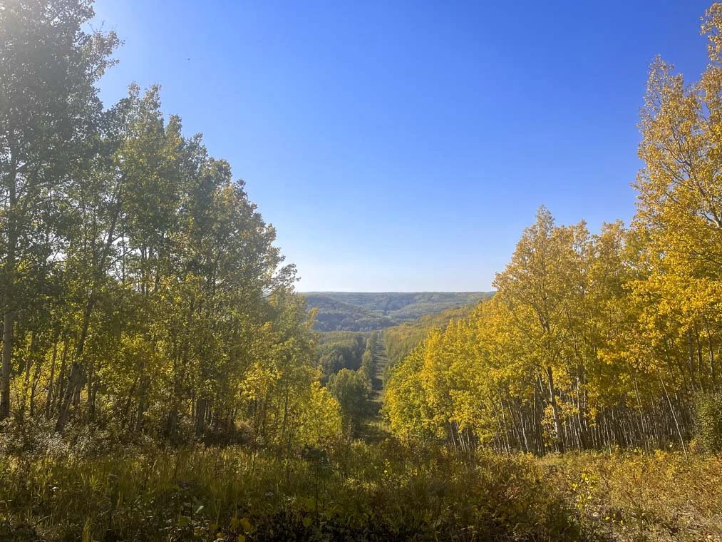
The Peace River Sustainable Forestry & Agriculture Project covered an area of 12,982 hectares (32,079 acres) located in the boreal forest north of Fort St. John, British Columbia. Tesera developed a High Resolution Forest Inventory Solution, over the treed portions of the BC Peace River forest property area of interest, based on a buffered data coverage area extending 100m beyond the area of interest (AOI), for a total data coverage area of 15,056 hectares (37,204 acres).
The land includes a mix of forest and agriculture. The forest stands consist mainly of aspen and spruce trees located along the forest fringe between agriculturally dominated land and boreal forest. This region has undergone dramatic change over the last century. Since the 1950s, agricultural development in the area has expanded to nearly 2 million acres. In addition, the region has another 1.3 million acres of land that the government of British Columbia is prioritizing for agricultural expansion. There has also been a significant expansion of the industrial footprint in the region from hydroelectric and oil and gas development in recent years.
The Peace River property exists in a unique landscape with a balance of wilderness and agricultural land. Throughout the patchwork of grain farms and cattle pastures are large expanses of aspen parkland and boreal forest. Endangered and globally important species such as woodland caribou, grizzly bear, cougar, lynx, wolverine, and wolves reside on the lands. Moose, mule deer, white-tailed deer, and elk are also essential to the ecosystem and support the region’s predators, as well as local subsistence and recreational hunters.
Perimeter Forest was seeking to develop a new forest inventory database for its Peace lands. Perimeter acquired the property to contribute to sustainable forestry and agriculture in the region.
The new forest inventory database significantly improves the resolution and accuracy of forest landscape, stand and tree level attribute data. These inventory data improvements will also enable the development of sustainable forestland management plans and activities, carbon credits (sequestration and abatement), optimize harvest scheduling plans and activities, as well as support watershed protection, enhance wildlife corridors and protect endangered and vulnerable species.
“Perimeter Forest has had a very positive experience working with Tesera. They are a very experienced and efficient team that has delivered a high-quality inventory product on time and on budget. This inventory now provides us with an unparalleled resolution of our forestland attributes that we can apply to our forest and biodiversity enhancement activities and achieve a level of transparency for our carbon projects that is nothing short of impressive. We look forward to continue to work with Tesera and HRIS as it allows Perimeter Forest to achieve our goals.”
Daniel Andres, Chief Operations Officer, Perimeter Forest Limited Partnership